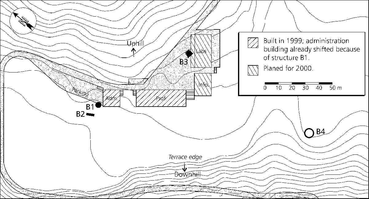
Fig. 9 - Sketch map of the construction site for the governmental
agronomic research center on the 70m-terrace at Batpalathang. Features
the locations of the discovered archaeological structures. The RNR
research center consists in four large buildings, a central yard, a
parking lot and a blacktopped access road. B1: underground stone
structure; B2: stone wall remains; B3: trapezoid stone platform; B4:
undetermined ruin. Map: R. Blumer 1999-2000, redrawn from RNR-RC Jakar /
Helvetas Bhutan 1999:2.